For the
sake of completeness I will recap a little.
A welcome dawn on
passage.
We arrived
in Opua at dusk on the 9th of November. Then tied up to the
quarantine berth, and went to bed. We had called the customs people by radio
earlier in the day, so we knew we wouldn’t be disturbed until 9 o’clock in the
morning. How civilised.
Opua marina
provided an opportunity to relax a bit, catch up with other sailing friends,
and spend lots of money. Willis Sails helped us out here by making us a new
Main sail and Spinnaker. So now we have a complete set of cruising sails from
this fine sail maker.
Other large investments were an ipad and an AIS
transponder. The former you will know better than me. The latter is a wonderful
piece of electronics that gives the position, course, speed and closest point
of approach of ships in a 60 mile radius. It also tells them the same
information about us. It should greatly assist the lookout on watch, with the
task of collision avoidance.
Rangihoa. Pohutukawa.
Bay of Islands.
We spent
December visiting old haunts in the Bay of Island and exploring the Cavalli
islands, a little further north. We found the Cavallis to be even better than
the Bay of Islands. Much more remote, lots of interesting navigation, and plenty
of sheltered anchorages.
Whangaroa in
the Cavallis was noteworthy not just for the complete protection it provides
from any wind, but because of its narrow and hard to find entrance. As we
approached the sheer cliffs dead ahead, we stared through the binoculars but
could see nothing! I rushed down below
to re check the chart and the GPS. Then, all of a sudden, there it was, no
problem! But I wouldn’t want to enter in
a gale.
Our reward for braving the entrance (easy on subsequent visits) was a
perfectly sheltered anchorage with good holding off Milford Island.
Mahinepua Bay.
Whangaroa. Cavalli Islands.
Mahinepua
Bay is yet another very attractive anchorage and had the bonus of providing a very
pleasant walk.
After doing
a little more exploring, we returned to Whangaroa to take up local residents
Richard and Joy’s offer, of driving us to Opua to attend an Ocean Cruising Club
party. We expected the lift, but were also treated to an unexpected hot shower,
and lunch in their delightful house. How kind.
The party
itself was hosted by Nina and Tony Kiff. As one would expect it was packed with fellow
matelots and a grand time was had by all. What we couldn’t possibly have expected,
was to meet Roger and Frances Robinson.
As well as having sailed with Tillman, Roger had sailed in Sula!!! Then named Slooper of Armoy, with her
previous owner Jeremy Knox.
Another
port of call was Mangonui Harbour. It proved to be a fine harbour and pleasant
village. We bought provisions including beer, rum and whisky (Glenmorangie) at
the bottle store. And grub from the supermarket. However we decided against
fish and chips, even from the reputed “World famous fish and chip shop”.
Brodie’s Creek.
Brodie’s
Creek was the northern limit of our cruise. From there we worked our way back
to Opua, calling in at a few anchorages we had missed out on our way north.
The fine islands of Hamaruri and Panaki are very
close to the site where the Rainbow Warrior has been laid to rest.
Older
readers will remember that she was sunk in Auckland harbour in the mid-eighties.
Two limpet mines were placed on her hull by French Secret Service agents, as
she was preparing to sail for the Tuamotu Islands, to protest about the French
nuclear bomb testing.
Hamaruri Island
As January
approached it was time to be heading off once again for Whangarei, our stepping
off place to the South Island. As well as having a good boat yard and an airport,
it also had a number of convenient hill walks. And we desperately needed to do
something about our atrophied walking muscles.
On one of
our walks we were joined by Clive and Stephanie. Stephanie being a cousin of
Jane Ball, a good friend of ours from Yelverton in Devon. We had an enjoyable
time with them, and I was able to swap old navy yarns with Clive, who had also
served in the Royal Navy. Though he rose rather higher than my ‘Captain of the
Heads’.
Bream Head (on another
occasion).
Our old and
faithful dinghy had a heart attack. One of it’s valves was playing up, and
while Pippa was trying to fix it, an essential part blew out and went for a one
way swim. She saw it describe a perfect arc over the guard rail, make a small splash,
and sink without trace.
Stop Press.
A repair
kit was flown out to us and we have affected a repair.
The 21st
of January 2014, saw us at the Norsand jetty in Whangarei, awaiting our haul
out. The forecast was for force 8 or 9 winds! However, in the morning only a
moderate breeze was blowing. We were due to wait until another yacht was
launched. But sensibly, the owner decided to stay put.
I got a phone call from
the yard manager inviting me to move alongside his jetty asap before the wind
got up. I was only too glad to oblige. In due course Sula was put in a cradle,
hauled out of the water and parked in a sheltered part of the boat yard. It was time to go Tramping.
“Let’s just take a
line to that post”
0615 on
Saturday 1st February 2014.
Our taxi
arrived only a few minutes late and ferried us to Whangarei airport.
A toy like
19 seat aeroplane awaited us on the runway. It had real propellers! There was
an aisle, but with only one passenger on each side, and ten seats deep. The
missing seat was to allow room for the door. The pilot, who hadn’t got a door to
his cockpit, was a real grown up. They must have shoe horned him into his seat.
The steward doubled as the co-pilot, or perhaps it was the other way round.
Nevertheless we were conveyed in comfort during the one hour flight to
Auckland.
Once there we had to dash to the check in for the connecting flight
to Wellington. Then we had time to stroll round the waterfront, looking at all
sorts of things you might expect to see at an historical harbour. And jolly
nice it was too.
The
penultimate leg of our journey was aboard the Blue Bridge ferry, which took us
to Picton in the Queen Charlotte Sound. Picking up our pre booked hire car was
a breeze, and we were soon ensconced in a cabin at Smith’s Farm Campsite.
Our efforts
to arrive at some sort of walking fitness in Whangarei paid off, and we were
soon doing respectable, if easy tramps. Not walks. Not hikes. Not rambles you
understand, but Tramps. We were, after all, in New Zealand now.
Wikipedia
describes tramping thus:-
…recreational activity involving walking over
rough country carrying all the required food and equipment, for trips of at
least one overnight stay in the backcountry.
We decided
to avoid the Great Walks. They are overcrowded and normally have to be booked
in advance, The huts are much more expensive. And the tracks themselves are
over- groomed.
On an early
coastal walk we came across Cable Bay. The starting point of a successful underwater
telegraphic cable laying project, to Sydney Australia, in 1876. I’ve just checked with the chart, and that’s a
minimum distance of 1,150 nautical miles. Quite some feat of engineering.
Not Onamlutu, but
another lovely campsite.
We enjoyed
the Department of Conservation campsite at Onamlutu for just $6 per night, a camping
ground with an immaculately mown lawn, surrounded by trees. We were serenaded
by a huge orchestra of cicadas and various birds, all singing their heads off;
quite wonderful.
The first
real mountain we climbed was Mt Patriarch. We had been staying at the Lake
Chalice DOC hut, after doing a steep tramp, through dense woodland that
eventually led to a minor peak known as the Old Man.
Lake Chalice Hut.
The
following day we rose early and set out to climb Mt Patriarch.
We drove to the
end of a dirt road. And from there we were treated to a long and hot walk. Some
excellent scrambling was encountered halfway along a ridge, with a fair amount
of exposure that focused our minds wonderfully. It was certainly no place to
slip. We were even provided with some quite tricky route finding in places. The
Old Man and Mt Patriarch had us itching for bigger and better things.
By now we
had learned that many tramps mentioned in our guide book, didn’t go to the
summits at all. They are old Maori trading routes, or perhaps hunting paths
that provided multi day tramps, without ever getting above the bush line.
Another
tramping feature we came across is the use of river beds. It is quite common in
these parts to have to ford an ice cold river, or even follow one up or down
stream for some miles. Heavy rain could, and does, cause rivers to rise to a
dangerous level, leaving one with no option but to walk back to a hut, or
bivouac until conditions improve. We took care to avoid such tramps if possible.
It got deeper and
colder with every step!
Despite
what I have just said about river crossings, Mt Armstrong provided us with a
grand day (or two) out. We waded across the Haast River below the Fan Tail
falls. It really hurt. How can water that cold remain a liquid?
We were
rewarded with a pleasant three hour walk to the excellent Brewster Hut. The
following morning we left early and quietly to avoid disturbing the other occupants. An enjoyable scramble past many
bluffs led us in an hour or two to the fabulous summit. We relished the 360°
panorama of the mountains, and especially fine views of the snow-capped Mt
Brewster.
Mt. Brewster.
The first
three days in March were spent in the excellent company of Steve and Lynne
Brodie in their house in Frankton, near Queenstown. Steve was enjoying his rest
days from guiding on the Milford Track (a Great Walk.) He and I had in the past
worked together, at the Prince’s Trust Activity centre.
We took the
advice of a local tramper we met in a DOC hut. He thought the Green Lake was a
stunningly beautiful place. The walk sounded pleasant enough so we went to have
a look.
It had snowed the day before we arrived and poor weather was forecast.
So we thought it best to get a move on. I’m so glad we did. It was a smashing
walk. The upper reaches of Eldrig Peak were covered in new snow, as were all
the high points we could see. The climb was easy enough but we needed to take
care in the prevailing conditions. The decent was a tad tricky, and quite
honestly I don’t think I chose the best line. So we tottered down the steep
snow covered slopes of our mountain with great care.
Eldrig Peak.
Green Lake
It was
mandatory of course for us to visit Milford Sound, but we chose a bad day for
the visit. The mist was low and we only caught the odd glimpse of the high
mountains. What we did see though would have made the ancient Maoris weep.
They
thought the sound to be the most beautiful place on earth. So beautiful in fact
that Hine Nui Te Po, the god of death, had invented Namu. The vicious biting Sandfly
(midge) to deter people from staying too long.
What we saw
though, was a huge booking office and car park, dozens of camper vans and many tourist
coaches. On the water were several large tripper boats. Is nothing sacred?
Apparently not, Mammon rules.
Milford Sound 1
Milford Sound 2
All was not
lost however. We later tramped our way to the Gertrude Saddle and scrambled up
perfect gabbro rock on the Barrier Knob. The tramp was good enough in its own
right, but we were further rewarded with stunning views of Milford Sound and
Mitre Peak. Sans tourist industry.
Piopiotahi (Milford
sound). Ahh that’s better.
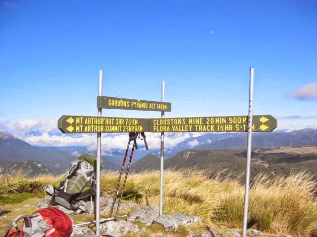
One of our
favourite tramps was Mt. Arthur via Gordon’s Pyramid. We set off from the
Salisbury Lodge, delightfully set in grassland with fine views of the
surrounding hills. A steep climb with some scrambling led to Gordon’s Pyramid.
There
followed a pleasant walk to join the Mt Arthur track. Then things became less
clear. ”It must go over there”. “But that’s much too far away”. ”But that way’s much
too steep”.
In the end things sorted themselves out. A good and well marked
trail,led up and over, then sidled round and across the most unlikely limestone
terrain. I certainly took my hat off to the original path finders. It was a
magnificent piece of route finding. For them that is. Not us. We just followed
the track and marker poles!
Gordon’s Pyramid.
Mt Arthur. The summit
ridge.
Soon
afterwards our tramping holiday was over. The New Zealand mountains are
magnificent. It took us a while to get into the swing of things, but once we
did it all clicked together.
We couldn’t
climb the highest mountains because of:- Our lack of mountain fitness. Lack of
alpine equipment and bad weather. Nevertheless we had a wonderful time.
Our return
to Whangarei was easy and entertaining, first on board the ferry and then the small
aeroplane, which took us to within a short taxi drive of Norsand Boatyard and
Sula.
Back on board, the jobs list was waiting for us. We have been hard at
work since then, getting Sula ready for another ocean passage.
We are due
to launch on Tuesday the 29th of April. Then we sail, as the weather
allows, to Opua. This will be our shakedown cruise. Once back in the Bay of
Islands, we will be studying the weather forecasts. And waiting for the optimum
time to depart, on the two week (ish) passage to Bundaberg, Australia.
To be
honest I’m a little worried about Australia. It seems that all the wildlife is
out to get you. Pippa found a reference to poisonous beasties. It seems that out of the ten most venomous
snakes in the world, Australia has ten of them!
Well that’s
it really. I could have bashed on lyrically for hours, about this wonderful
island. But I just don’t have the time. Perhaps I need a holiday!
I’m quite
sure that had I come to New Zealand twenty or more years ago, I would have
stayed. They won’t have me now. I’m too old and not rich enough. Not that I’m
complaining though. I do miss my friends and family, and of course my hole in
the river bank.
To
conclude, here a few more pretty pictures. In no particular order:-
The Brewster hut.
Oh what fun! Stuffing
box maintenance in Whangarei.
The Moeraki Bolders.
Near Otago.
Moeraki Bolders 2.
Able Tasman National
park
Honeydew and
Lichens on NZ Beech trees.
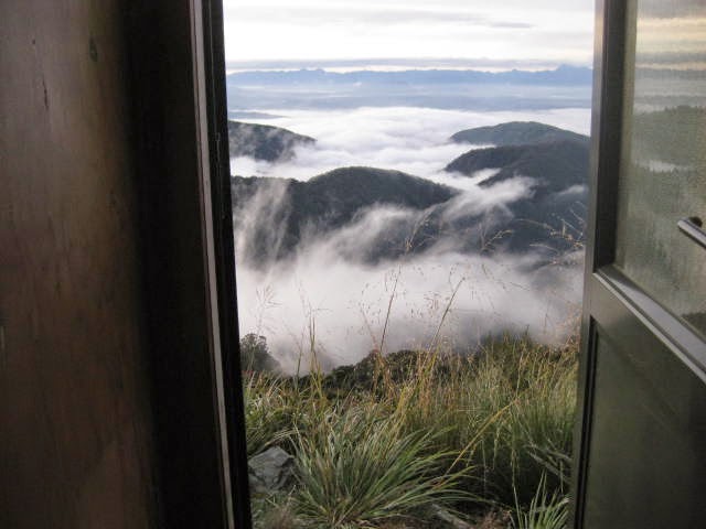
The view from the loo
at the Ces Clarke hut.


